
Records Behind Marion County Neighbors
A responsible block lookup answers small questions with the right source. The parcel map defines which lots are adjacent. Property cards name title owners. A requested voter file may show registered voters at an address unless an exemption applies. Permit and code records describe work or cases, not a household. Public association contacts identify the group serving an area, but they do not create a public roster of Marion County neighbors.
| Source | What It Shows About a Block | Access |
|---|---|---|
| Marion County GIS | Touching parcel shapes, aerials, subdivisions, zoning, and land use | Free interactive map; verify with the custodian |
| Property Appraiser roll | Owner, situs, mailing address, legal description, and parcel facts | Free property and map searches |
| Marion Elections voter file | Public registered address and precinct fields, subject to exemptions | Specific data request; not a browse-by-block screen |
| Permits and code records | Dated applications, work, inspections, and case activity | County Civic Access or the correct city custodian |
| Community contacts | Public boards, association contacts, boundaries, and meeting notices | County Municipal Services, public pages, and Sunbiz |
These categories cannot be merged into one resident roll. An owner may live elsewhere. A renter may never appear on the parcel card. A protected voter can be absent from a released file, and private HOA membership is not presumed public. Record the date and stated role attached to each name. That keeps a deed owner from being mislabeled as a current occupant.
Marion County Neighbors Need Maps
Consecutive street numbers can fail badly in Marion County. Rural acreage, flag lots, roads, curves, later parcel splits, and large tracts can put the numerically closest address far from the target. The better test is whether parcel polygons touch, with aerial imagery and subdivision boundaries used to interpret the land. A road may separate two parcels that look close in an address list, while a long narrow lot may reach behind several homes.
Use the county's GIS Interactive Map for parcels, zoning, future land use, overlays, aerials, and base maps. The published GIS layer contains a 12-character parcel field plus situs and ZIP attributes. Its service supports distance queries, but the research did not verify a consumer-facing buffer button. Do not promise a one-click radius tool that may not exist.
Note: An Ocala mailing label does not prove that a parcel is inside Ocala city limits or subject to Ocala's record custodians.
Map a Marion County Block
Start with a known situs address, which is the parcel's physical location. Locate it in the Property Appraiser map, then work outward one polygon at a time. The aim is a small list of actual adjacent parcels, not every owner on a long road. Save the parcel identifier and legal description for each result because names and street labels can change.
- Search the target address in Map It+ and confirm its parcel card.
- Click each polygon that touches the target, accounting for roads and odd lot shapes.
- Open each property card and record owner, situs, mailing address, legal description, and tax-year context.
- Treat matching situs and mailing addresses plus homestead as supporting owner-occupancy evidence, not a household roster.
- Use the By Street only when the question expands to the full named street.
The Property Appraiser comparable-sales search can add nearby transaction context after the parcel set is defined.
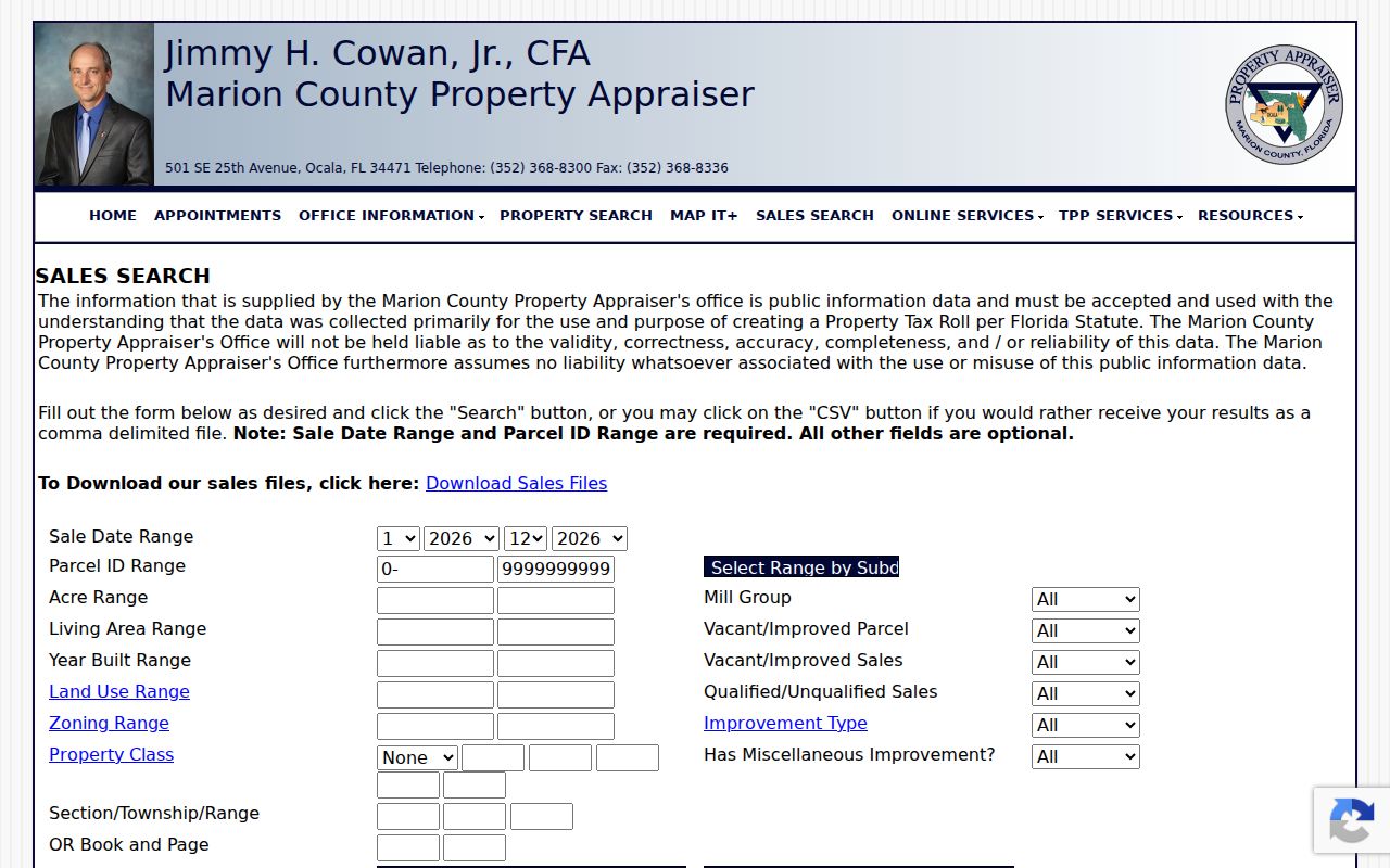
The screen is useful for property comparisons, not for naming every person on the block. Confirm ownership on the individual card and any transfer in Clerk records.
City Records Around Marion Neighbors
County parcels cover all of Marion County, but municipal permits and code records stop at city lines. Belleview's official BS&A portal searches All Records, Business Licensing, Building Department, and Utility Billing through address, name, parcel number, and record-number modes. Its address form accepts a street address or a number range. The portal's presence does not establish that a utility customer's identity is public, so verify a result or ask the custodian.
The Belleview address-record screen demonstrates how a local portal can differ from the county system.
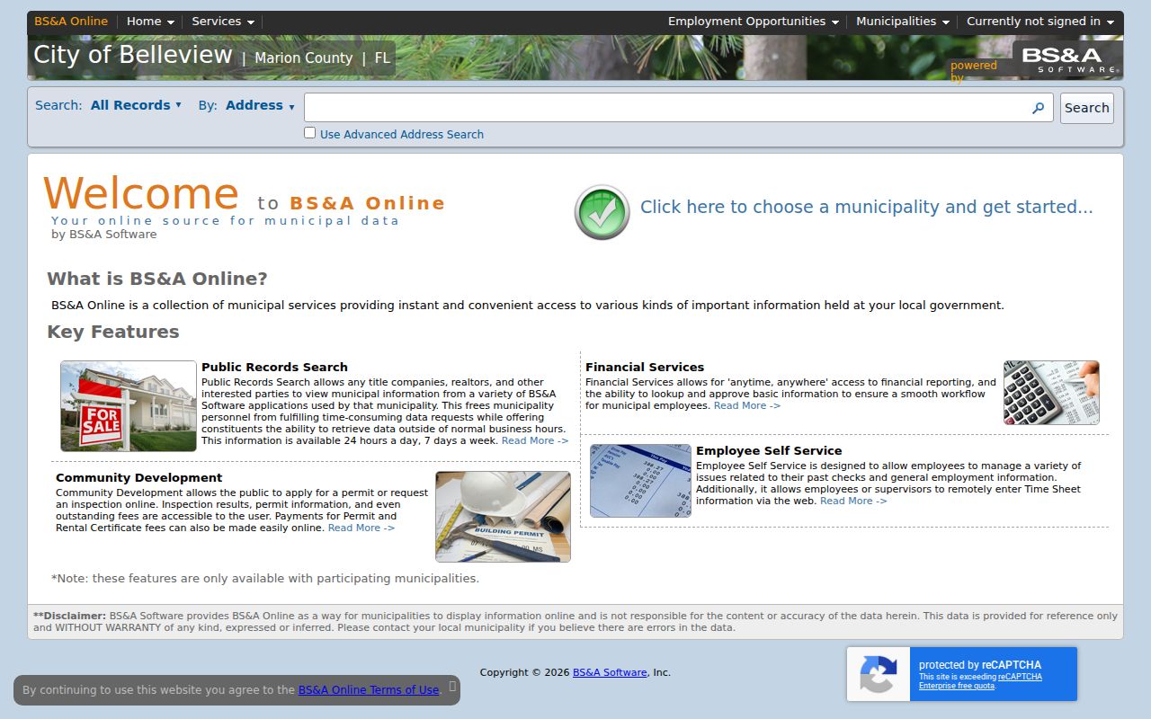
For Ocala, use eTRAKiT and the city records custodian. County Civic Access covers county Building Safety, right-of-way, zoning, Code Enforcement, Development Review, and zoning plans. Dunnellon accepts requests in person, by phone, or form. Always route the address to the government that held the file.
Voter Clues for Marion Neighbors
The Marion Elections self-service registration tool is for a voter's own status. It is not a browse-the-block directory. For public voter data, send a specific request through the Elections data-request channel. Staff consults on criteria and format, with comma-delimited text or PDF available. Electronic email or FTP delivery is free when no charge is incurred, and the office publishes a five-business-day processing target that may lengthen at peak times.
Public fields can include registered name, residence or mailing address unless exempt, party affiliation, registration date or status, precinct and district, and elections in which the voter participated. Ballot choices are never public. Social Security numbers, driver-license or Florida ID numbers, registration-location details, preregistered-minor records, and signature copies are restricted under Florida law.
The precinct and voting-location finder accepts a house number and selected street name.
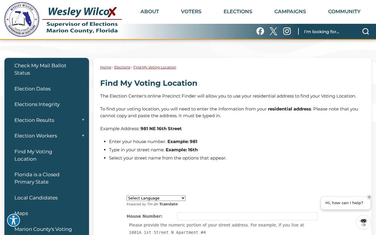
Its result identifies a precinct or voting place, not the names of nearby voters. Suppressed addresses and inactive-record rules also make any block count incomplete.
Marion County Community Contacts
Marion County Municipal Services manages more than 60 municipal service taxing and benefit units, districts, and advisory boards. County outreach names Marion Oaks HOA, Stone Creek HOA, SummerGlen Owners Association, Del Webb Spruce Creek, Oak Run, Stone Crest, Citra Improvement Society, Orange Springs Civic Center, and On Top of the World/Circle Square Commons. These are useful paths to meetings and public contacts, not a county resident list.
| Community layer | Responsible use |
|---|---|
| County district or advisory board | Confirm boundary, agenda, public board member, and custodian-held records |
| HOA or owners association | Use a voluntary public contact page; do not infer or publish a private membership list |
| Civic group or center | Find public events and officers, then verify any entity through official filings |
A public Property Appraiser records request can help when standard cards do not answer a parcel question.
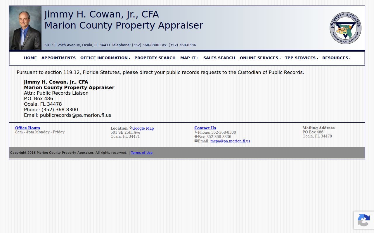
The request channel should ask for a defined record or parcel set. Florida Public Records Law does not require an office to create a private-neighbor roster that it does not keep.
Compare Marion County Neighbor Sources
Official rolls and commercial neighbor tools serve different purposes. County records expose the source, custodian, date, and legal meaning. Commercial compilations can merge old addresses and unrelated people without showing how the link was made. Use the compilation category only as a lead, never as proof.
| Source type | Strength | Limit |
|---|---|---|
| Parcel and GIS records | Defined land and title-owner context | Does not list all occupants |
| Voter data request | Dated registration and precinct fields | Exemptions and nonvoters create gaps |
| Public community records | Official contacts and service boundaries | Not a private membership roster |
| Commercial compilation | May suggest a name or old address | Can be stale, merged, or unsupported |
Confirm any useful lead against the office that keeps the underlying record. When a protected address is missing, do not try to defeat the exemption.
Limits on Marion County Neighbors
Public property records identify taxpayers and title owners, not every person at an address. Household members, renters, delivery information, and private association rosters do not become public merely because a parcel can be mapped. Florida Safe Address supplies an eligible participant with a substitute mailing address and confidential forwarding. Other protected professionals and voters may qualify for address exemptions under Florida law.
A missing name can mean the person does not own, is not registered there, falls within an exemption, or simply moved after the record date. Never fill that gap by guessing. The sound result is a dated list of what each custodian confirms, with uncertainty stated plainly.
Lawful use. Look up Marion County neighbors for civic curiosity, reconnecting, or personal safety. Never use public records to watch, stalk, harass, intimidate, or harm anyone.
Verify a Marion Block Snapshot
A block lookup should end with a source and date for every claim. Parcel boundaries show land next to land, not social ties or every household member. Open each adjoining property card, compare its situs address with the mapped polygon, and note whether a road, drainage tract, large acreage parcel, or flag lot changes what “next door” means. Use a plat when subdivision lot and block numbers matter.
Owner names, permit parties, registered voters, and association officers describe different legal roles. Do not merge them into a private resident roster. If a protected address is missing, respect the exemption. For older neighbors, cite the exact reverse-directory year and check the 1958 Ocala street-name transition before matching house numbers across time.