
Walk a Marion County Street
A sound street search moves from the parcel to records made at a known time. Begin with the Marion County Property Appraiser because its location search accepts a street number or fragment. The roll covers county parcels, including land outside Ocala and other cities. Then use the map, deed index, election files, and old directories only for the facts each can support.
- Enter the number and street name in the Property Appraiser location search. Leave out city, state, and ZIP.
- Open the parcel card. Copy the situs address, owner, parcel number, legal description, and Official Records book and page.
- Use Map It+ or county GIS to follow parcel lines along both sides. Vacant land may not appear in an improved-parcel address search.
- Follow the deed citation into the Clerk index. Check grantor, grantee, date, and legal description.
- Check the right permit system, request lawful voter data when useful, and consult a reverse directory for an older occupant.
The flow is address → parcel → owner → deed → dated supporting record. It avoids treating a mailing list as proof that someone now lives there.
Marion Street Records Compared
No single Marion County street directory supplies every owner and occupant. Each address source answers a different question.
| Record | Street evidence | Keeper | Limit |
|---|---|---|---|
| Parcel roll | Owner, situs, mailing, legal, values | Property Appraiser | No occupant list |
| GIS | Boundaries, aerials, zoning, subdivisions | County GIS | Informational map |
| Official Records | Deeds, liens, plats, mortgages | Clerk | Web is not full archive |
| Permits/code | Project, applicant, contractor, dates | County or city | Not residence proof |
| Voter file | Public address and precinct fields | Marion Elections | Exemptions apply |
| Reverse directory | Dated occupant or business by address | Library | Years not continuous |
Sanborn maps add building outlines and old street labels, not resident names. Modern parcel facts begin at the Property Appraiser search.
Search Marion Streets by Address
The Property Appraiser offers more than a basic box. Address searches cover improved parcels, accept fragments, and use standard suffixes. A blank may be vacant land. Parcel, subdivision, sales, map, and deed-reference modes provide other routes.
| Choice | Input | Use |
|---|---|---|
| Location | Number and street | One improved parcel |
| Owner Name | Surname or organization | Test an owner lead |
| Parcel | Identifier | Exact parcel |
| Subdivision | Name or ID | Split a long street |
| OR Book/Page | Four or eight digits | Connect deed citation |
| Map It+ | Map | Nearby and vacant lots |
The detailed property screen shows these routes.
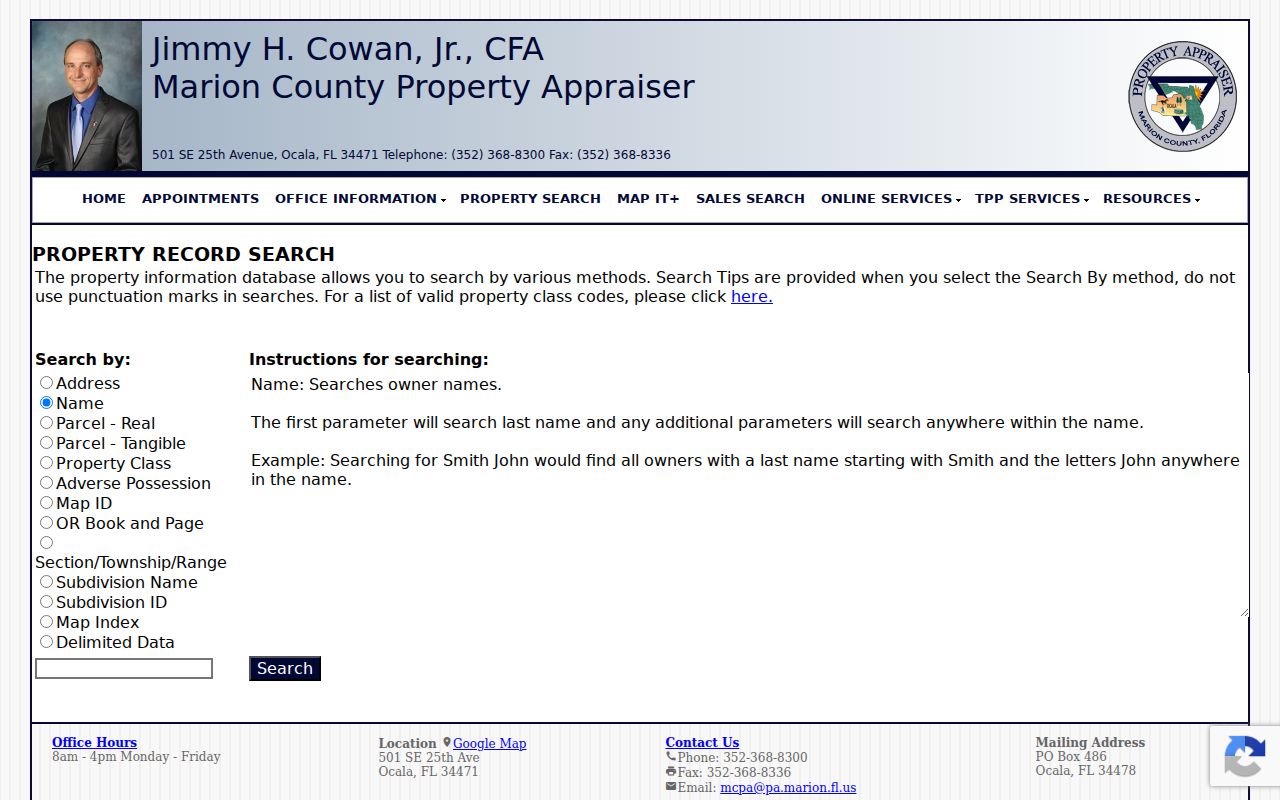
A parcel number or subdivision often fixes an address spelling problem.
Read Marion Parcel Cards
A parcel card separates the land's physical location from the address used for tax mail. The situs is the site itself. Mailing is where notices go. Matching them, with homestead, supports possible owner occupancy but never proves a household.
- Parcel
- A land unit used for mapping and assessment.
- Situs address
- The physical location, distinct from owner mail.
- Plat
- A recorded plan of lots, blocks, and roads.
- Criss-cross directory
- A book arranged by street and number.
Record tax year, owner, legal description, land use, sale data, buildings, exemption context, and deed reference. Protected addresses may be withheld. The map entry moves from list to street view.
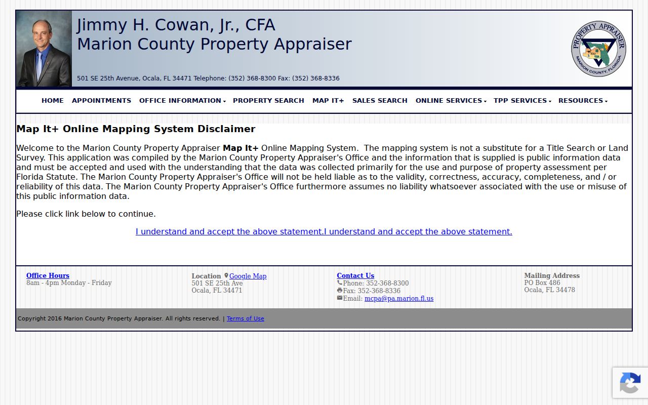
Mapped polygons, not just consecutive house numbers, show how lots meet.
Map Marion Street Parcels
The county GIS viewer adds parcel lines, subdivisions, zoning, future land use, overlays, aerials, and base maps. Its published layer includes a 12-character parcel field, situs lines, ZIP, and property class. It supports distance queries, though no consumer-facing buffer button should be promised without checking the live viewer.
Pan down one side and click each parcel, then return along the other. In rural Marion County, the next number may be far away, across a road, or behind a flag lot. Polygons and aerials explain the physical street. They still do not establish who sleeps in a home.
Note: Vacant land may appear on the map when the improved-parcel address search has no row.
Link Marion Streets to Deeds
Use the parcel's book and page in the Clerk Official Records search. A grantor transfers an interest; a grantee receives it. Compare the legal description, then search a seller as an earlier grantee to move back through title.
The Clerk says regular images from 1967 forward can be viewed and printed online. A historic portal covers 1959 through 1964. Earlier deeds and certified copies go through the Records Center. Another Clerk page cites 1965 for some material, so keep each cutoff with its series. Research fees are $2 per name per year, copies $1 per page, and certification $2 per document.
Check Marion Address Permits
Permit records belong to the government with jurisdiction. County Civic Access covers Building Safety, right-of-way, zoning, Code Enforcement, Development Review, and plans. Ocala uses eTRAKiT. Belleview's BS&A searches address, name, parcel, and building record number. Dunnellon takes requests through its clerk.
The Ocala permit search exposes Search By, Search Operator, Search Value, and map tools.
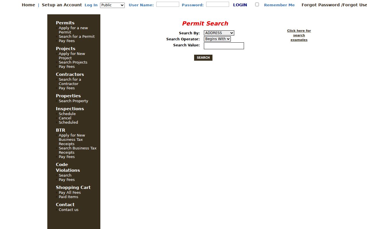
A permit can date work and name an owner, applicant, or contractor. It does not prove residence. An Ocala mailing label also does not prove city jurisdiction. Check GIS first.
Request Marion Street Voter Data
The status tool is a self-lookup, not a block list. Marion Elections accepts focused voter-data requests and consults on criteria and format. Results may be comma-delimited text or PDF. Email or FTP delivery is free; postage or chargeable work is invoiced. The target is five business days, but peak periods can take longer.
The data-request page explains the route.
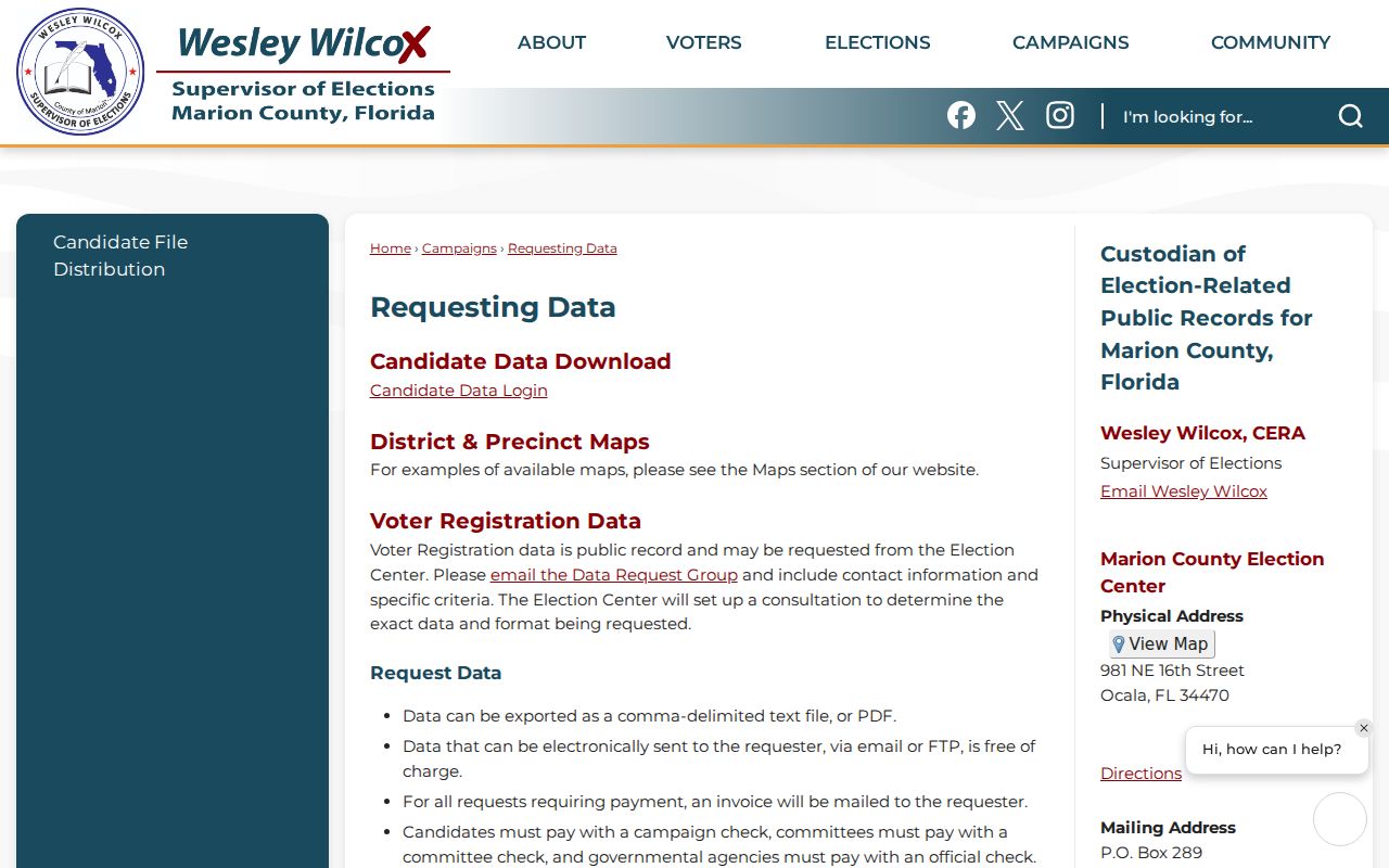
Public fields can include name, address, party, status, precinct, districts, and election participation. Ballot choices are never shown. Identifiers, signature copies, minors' preregistration, and protected addresses are restricted.
Bridge Ocala Street Names
Ocala adopted its quadrant naming system in 1958, and most streets were renamed. An old address may fail even when a family did not move. Compare directory issues before and after 1958, then match the lot through a plat, legal description, or deed.
Sanborn maps survive for 1884, 1886, 1888, 1891, 1895, 1901, 1906, 1912, and 1924. The last has 34 sheets and related Oak, Zuber, Fort McCoy, and Reddick coverage. Maps reconcile buildings and old labels, not occupants. The City Directories hold the dated name layer.
Note: Keep old and new forms together so later searches do not turn two names into two places.
Normalize Marion Street Addresses
Try full and short directions, remove punctuation, and search the core street name before adding Road, Avenue, Lane, or Boulevard. A corner parcel may use the cross street as its official situs even when its mailbox faces the road being studied. Keep both forms. Let the parcel number and legal description control the match because they survive spelling, numbering, and mailing changes.
Choose the source by question. Parcel and deed records are strongest for title. GIS is strongest for lot shape. Permits date work. Voter data describes registration at one point. Reverse directories are a historical occupant source when the right issue exists. These roles keep a land or construction record from becoming a claim about a whole household.
Common names should not be merged merely because they appear on one street. Compare a middle initial, spouse, parcel or instrument number, legal description, and date. A seller may leave Marion County, buy another parcel, or share a name with someone nearby. When facts remain uncertain, label the result as an unresolved lead.
Request Missing Marion Street Records
A failed web search should lead to the custodian that holds the series. The Clerk Records Center handles older recorded books and certified copies. The Property Appraiser has its own public-records request route. County records not assigned to a separate constitutional office can go through Marion County's request channel. City records must go to the city custodian when the parcel lies in that city.
Make the request narrow. Give the normalized address, parcel number if known, record type, department, and date range. Ask for electronic files when practical. Custodians can verify public fields tied to a parcel, book and page, or request number, but they cannot perform open-ended research for every person on a road. Save the source URL, tax year, recording date, and terms used so a later owner change can be corrected.
Jurisdiction deserves its own check. Ocala, Belleview, Dunnellon, McIntosh, and Reddick keep some municipal series, while large parts of Marion County are unincorporated. County parcel coverage does not make the county custodian the keeper of a city permit or code case. The postal city line may also differ from municipal limits. Confirm the parcel on GIS, identify the responsible office, and only then submit the address request.
Limits of Marion Street Directories
Ownership, mailing, registration, permitting, and occupancy differ. Trusts may own land. Owners may receive mail elsewhere. Renters and household members usually do not appear on parcel rolls. Utility and motor-vehicle addresses are not public street directories, and protected records can be suppressed.
Use dates. A deed records a transfer, a card reflects a tax year, voter data captures registration, and a directory reports a past canvass. Fast growth across Marion County makes stale claims risky.
Confirm Marion Street Results
A street directory result is strongest when the parcel, recorded deed, and jurisdiction agree. Save the 12-character parcel number and full legal description before moving between portals. Street spellings, directional prefixes, road suffixes, and Ocala's older street names can vary, while the legal land identity is more stable. If a location search misses, try a short street fragment and omit the city, state, and ZIP. Then compare the mapped parcel rather than assuming the first similar address is correct.
Record the date shown on each source. Property cards may reflect the current tax roll, deeds reflect a transfer date, permits reflect work at a site, and voter data reflects its own registration cycle. None supplies a complete household roster. For a pre-1967 deed, send the Records Center the owner name, approximate year, book and page when known, and the legal description. This narrow request gives staff a much better search key than a modern street address alone.